|
Visitor Services Development Plan for for the David Thompson Corridor District
Alberta Parks
|
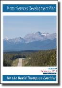
This recent project focuses on four major and three smaller Alberta Parks properties located along the David Thompson Highway (Why 11) between Rocky Mountain House and the eastern boarders of Jasper and Banff National Parks. The plan focuses not only on the parks properties but on the extensive areas of crown lands adjacent to them. This vast area has some of Canada’s most spectacular mountain and foothills scenery.
Following directions dictated by the province’s new Land-use Framework and Alberta’s Plan For Parks, this plan focuses on the balancing of protection of wilderness habitats, integrating a wide spectrum of recreational activities on park properties and crown land and engaging new and multiple-repeat visitors in meaningful interpretive experiences along a 320 km travel corridor.
Click here to learn more about this plan and to view sample pages.
|

|
Heritage Appreciation and Visitor Services Plan Rouge Park
Rouge Park Alliance, Greater Toronto Area
|
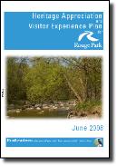
Completed in 2010, this plan is for Ontario’s largest urban park which is managed cooperatively by the province, the federal government, the City of Toronto and seven other municipalities and non-government organizations. Almost all these stakeholders own lands that make up this park. Multiple stakeholders and approaches to serving ethically diverse urban audiences are key issues dealt with in this plan.
Click here to view sample pages of this plan.
|

|
Visitor Services Development Plan for for the Fish Creek District
Alberta Parks
|
Completed in 2009, this plan for Fish Creek district encompasses Alberta’s largest urban park (Fish Creek Provincial Park) in Calgary plus a new near-urban park (Glenbow Ranch Provincial Park) to the northwest of that city plus a number of smaller rural properties lying within an 1 ½ hour drive of Calgary. Rapid urban expansion, pressures of increasing use and the need to engage urban audiences are key issues dealt with in this plan.
Click here to view the executive summary and table of contents from this plan.
|

|
Heritage Appreciation Development Plan for for the Beaver Hills District
Alberta Parks
|
The Beaver Hills district is a highland of knob and kettle terrain within an hour's drive from the major population centre of Edmonton.
We worked with a steering committee to develop Alberta Park's first regional interpretive plan. This plan integrated interpretation and education for four major park properties plus six smaller Provincial Natural Areas. A key component was the development of a partnership and collaboration section that identified key regional players in the delivery of interpretation and education services, plus directions for staff on how to set up and maintain partnerships with them. This section was used as a model for inclusion in all subsequent district plans.
Click here to view sample pages from this plan.
|


